Matanuska-Susitna Borough on the map of Alaska as of 2025. Cities, roads, borders and directions in Matanuska-Susitna Borough of Alaska.

USA / Alaska / Matanuska-Susitna Borough

Matanuska-Susitna Borough is situated in the southern/central part of Alaska. This glorious borough is named after the valley that the Matanuska and Susitna Rivers form. The total area of Matanuska-Susitna Borough is about 24707 square miles. This borough, created in 1964, is populated today by at least 111 thousand residents. Palmer is the borough seat of Matanuska-Susitna Borough. This map shows the borders of Matanuska-Susitna Borough as well as neighboring counties, including major highways and natural objecsts as of 2025. Zoom in or out of the map using the plus/minus panel. Move the center of this map by dragging it. Also check out the satellite map of Matanuska-Susitna Borough.


Share the link with friends:
Share on Facebook
Share on WhatsApp
Share on Telegram


The borders of Matanuska-Susitna Borough over the map of Alaska
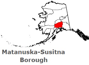
An image of Matanuska-Susitna Borough, AK

Explore some more counties of Alaska:

Full list of Alaska maps

This online map of Matanuska-Susitna Borough, Alaska is provided by Bing Maps. Please add a bookmark and share the page with your friends!