
Pinal County on the map of Arizona as of 2026. Cities, roads, borders and directions in Pinal County of Arizona.

USA / Arizona / Pinal County

Pinal County is situated in the southern region of Arizona. This interesting county was named after Pinal Peak, possibly from Spanish pinal - place of pines. The county seat of Pinal County is Florence. The county's area is 5,374 square miles. Founded in 1875, today Pinal County is home to 450 thousand Americans. This map shows the borders of Pinal County as well as neighboring counties, including major highways and natural objecsts as of 2026. Zoom in or out of the map using the plus/minus panel. Move the center of this map by dragging it. Also check out the satellite map of Pinal County.


Share the link with friends:
Share on Facebook
Share on WhatsApp
Share on Telegram


The borders of Pinal County over the map of Arizona
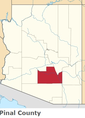
An image of Pinal County, AZ

Explore some more counties of Arizona:

Full list of Arizona maps

This online map of Pinal County, Arizona is provided by Bing Maps. Please add a bookmark and share the page with your friends!